SEGMENT 1
We left Los Angeles on June 16 around lunch time and headed north. A few
miles into the trip we were reminded of the weakness of Cherokees - overheating!
Therefore we were driving with the heater on in desert heat welcoming
the rainstorm that moved in from the coast in northern California and
cooled Jeep and passengers off.
We spent the night in the Shasta area which is supposed to be absolutely
gorgeous; however, it rained when we got there; continued to rain all
through the night; and still rained the next morning. On our way north,
we did catch a glimpse of majestic Mount Baker with its snow-covered peak
shrouded by thick, puffy clouds.
Portland, Oregon, had remained in our memory from our last trip as a vibrant city with great nightlife so we spent the late afternoon and evening there. Seeking shelter from a sudden downpour, we dropped into an Irish pub where a golf tournament on the TV screens was accompanied by Frank Sinatra serenading us from the loudspeakers - what was wrong with that picture? Needless to say, we only stayed long enough to finish our drinks.
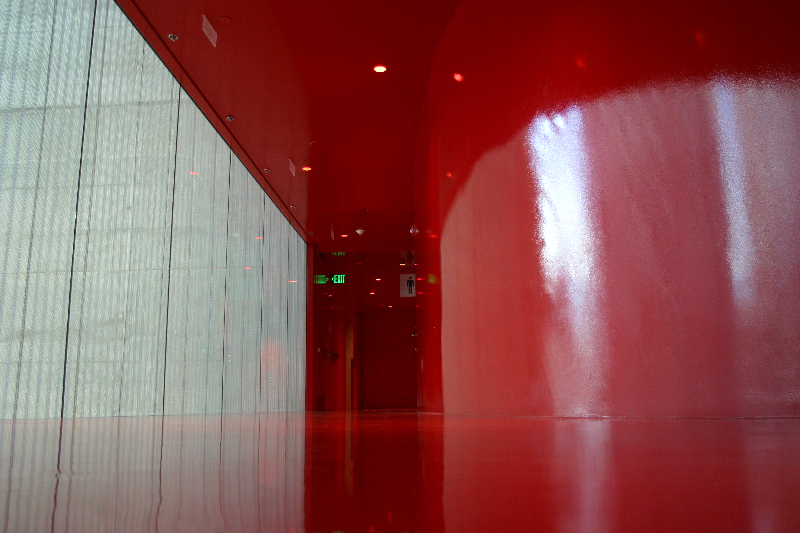
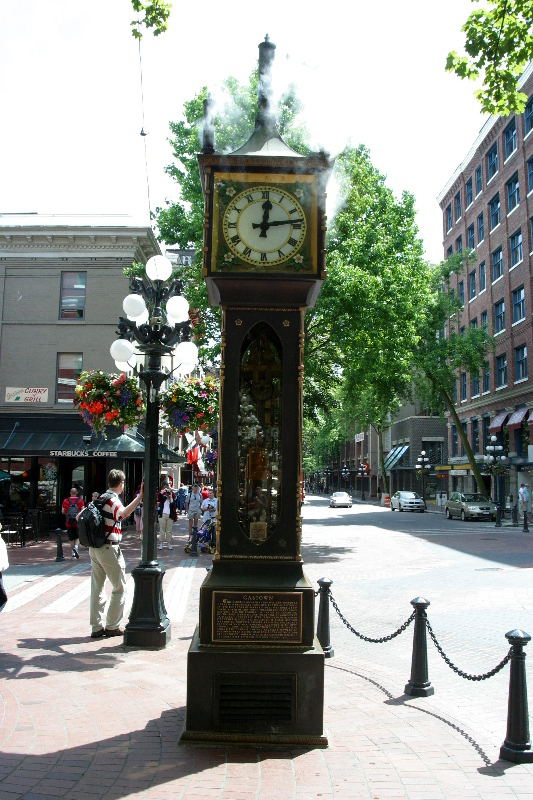
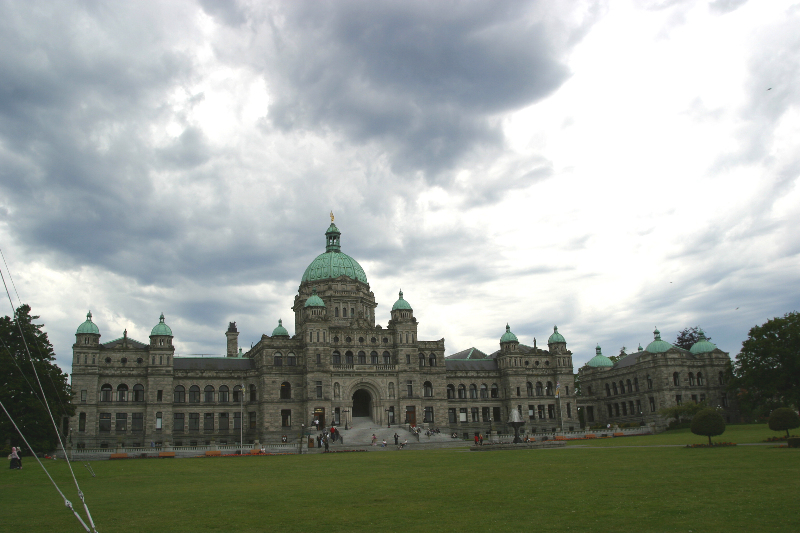
Reaching Seattle, Washington, we hooked up with some friends and painted the town until the early morning. We also visited the new library by Rem Kohlhaas (pic1) which is quite an impressive building. The next stop was Vancouver, Canada, where we were welcomed by some friends. We walked around downtown for a day and visited Gastown (pic2), Chinatown and Robson Strasse (not a typo, it's actually called that way!). The next day, we took the ferry to Victoria. The ride was quite spectacular as we cruised past small islands and numerous bays. Victoria has some great old buildings (pic3) but the atmosphere in the harbor is destroyed by the ugly apartment complexes surrounding the bay.
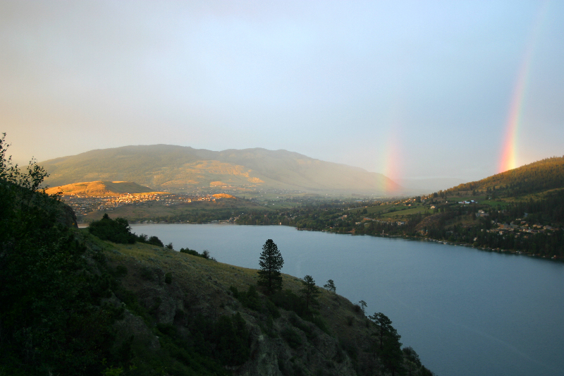
Wednesday June 22: Time to
push on. We headed east on HWY 1 to Osoyoos and followed the 97 north
along the chain of lakes. Some truly spectacular vistas (pic4) opened
up; like most visitors, we hadn't expected desert environment in Canada!
Apparently, this area is part of the same desert (geologically) that surrounds
Death Valley - the rolling golden hills did look familiar to us. The lakes
are fed by countless streams originating further north. We stopped at
one of the numerous lakes for a few hours, then continued north to Prince
George.
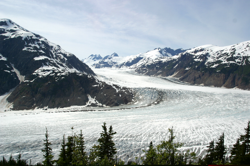
As we make our way north along the Cassiar Highway, we see forests and lakes, forests and lakes, and forests and lakes. We also start seeing more wildlife: bunches of deer, who seem little impressed by our deer whistle mounted to the front bumper (it emits a noise that deer supposedly don't like; it actually appears to attract them!); a few bald eagles; and two black bears. Since we had heard about the fantastic glaciers of Stewart, we detoured from the Cassiar HWY. This drive is absolutely spectacular for its views of the glaciers and rough mountain scenery. At Stewart, we crossed the US border (nobody checked our papers) and landed in Hayder (population 85) where we saw a black bear on the main road in broad daylight. The road became gravel and we followed it past a wildlife viewing platform (no bears - they prefer the village!) to the Salmon Glacier (pic5). On our return over the border we got to chat with the Canadian Immigration/Customs official who seemed less than thrilled to be stationed in the middle of nowhere. We continued north and enjoyed more wildlife: a fox, moose and another bear.
The farther north we get, the shorter the nights, the peskier the mosquitos, and the more remote the landscape. Whitehorse in Yukon Territory was a welcome opposite with plenty of cafes but the free internet access didn't help when it broke down all over the state of Yukon. Along the Klondike Highway we reach Dawson City, an old mining town without any paved roads, and take the free ferry across the Yukon River. Along the scenic Top of the World Highway with magnificent vistas, we reach the US border.
pic2
pic3
pic4
pic5
for more pics click here