SEGMENT 4
Do you know where the word "kangaroo" comes from? Apparently, an English surveyor asked a local Aboriginal: "Excuse me, local man, what do you call that strange creature that hops around on long hind legs and has a miraculously strong tail?" The Aboriginal man didn't understand any English and answered: "What did you say?" in his local language: "Gangoroo?" The Englishman: "Ah, thank you."
Australia has several world-renowned wine areas, the Barossa Valley probably being the most famous one. We had consulted a wineries guide and a knowledgeable acquaintance to help us make a selection amongst the more than 100 wineries and enjoyed a delectable day in wonderful scenery, tasting away through various reds. As Sven doesn't drink,we didn't even have to worry about the driving and drinking combination.
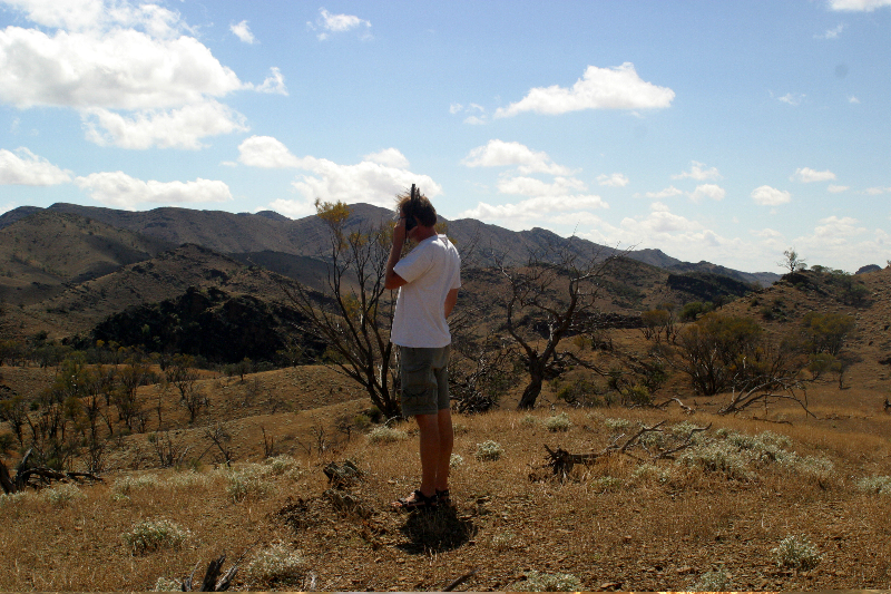
Now we were definitely ready for the Outback. Our first destination was the Flinders Ranges (pic01), a wonderfully rugged mountain range with a strange formation, the Wilpena Pound. This is a hilly syncline, or geological downfold, which resembles a meteor crater. Finally, we also hooked up with Dirk and Marieken, a couple from Holland with whom we'd been having a lively email correspondence ever since they spotted our truck in customs holding. They had been traveling the world for many months and we spent an entire afternoon and evening exchanging travel stories. Check out their website www.waarzijnjullienu.nl - if you don't read Dutch, you might at least enjoy the photos. Later in the evening, we were also joined by Manuela and Bruno from Switzerland and our little European enclave chatted for hours. The night sky out here is phenomenal!
The next morning, we left early for Skytrek, a 4x4 trail recommended to us by Matt from ARB. Many trails in this area are on private property and you have to obtain a permit from the owners. It was a fantastic excursion with incredible views. In this remote wilderness Sven was able to deliver birthday wishes to Austria thanks to our Satcom Direct satellite phone (pic02). Please read our Flinders Ranges and Skytrek report for details on this amazing area.
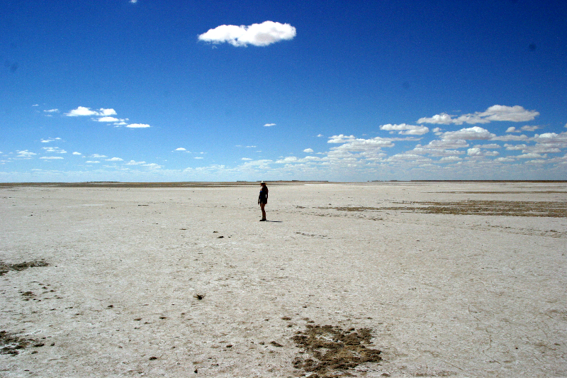
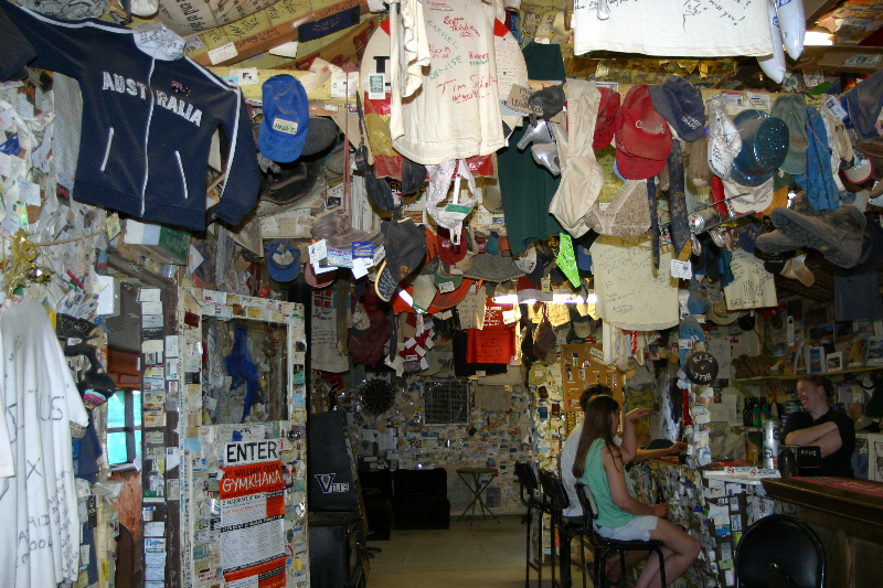
After leaving the Flinders, we stopped at the Prairie Hotel which pretty much makes up the settlement of Parachilna and serves the most enjoyable and creative burgers around (try emu or kangoroo!). Off we went north to start the Oodnadatta Track, a famous 4x4 route through the Outback. The track is unpaved but generally in very good condition so we could drive at an average of 50mph (80km/h). We passed through spectacular scenery: vast desert floors, colorful bushlands, vibrant red sand, and many salt lakes. The lowest point of Australia is in Lake Fromme (pic03), a huge dry lake which carries water only after massive rain falls. This is an unforgiving environment with hardly any water sources; the temperatures easily climb into the 100s F (around 40C) and as soon as you leave your car, you will be attacked by hords of highly annoying flies with a particular liking for ears and eyes. We were truly thankful that our new Customs Aluminum radiator had finally resolved our overheating problem so we could drive with the AC on and the windows closed. William Creek is a motel/pub/gas station and the pub is decorated with all kinds of strange things visitors decided to leave behind: driver's licenses, bank notes, t-shirts, and a fair number of bras…(pic04). The owner had a lot of interesting Outback yarn to share.
Late in the evening, we pulled into Coober Pedy, a settlement of a different kind, as more than half of its residents live underground to escape the heat. In fact, the name derives from an Aboriginal expression for "white man" and "hole in the ground". Coober Pedy is famous for its opal mines and supports approximately 80% of the world's opal industry. The underground churches are open to visitors and we were astounded at the detail that went into their decoration and design. Imagine our surprise when we ran into the Swiss couple from two nights earlier!
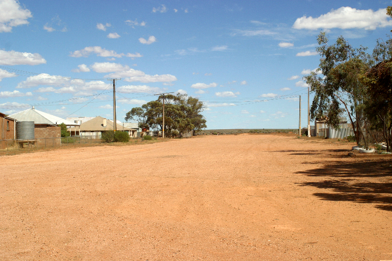
Heading south on mostly paved
roads, we took a shortcut on some rather rugged dirt roads. Although the
lady at the Coober Pedy visitor center had assured us that the gas station
in Kingoonya would be open every day ("Just knock on the door if
they're not there; after all they live there."), we found this settlement
abandoned (pic05). It looked like a ghost town and the gas station had
definitely closed years ago. Luckily, we carried plenty of spare gas in
our additional cans and were able to continue another 160 miles (250km)
to the Eyre Highway. A quick side trip recommended by a friendly local
took us to Fowlers Bay and we cruised around the impressive sand dunes
for a while before returning back to the main road where we started our
journey through the Nullarbor Plain. Nullarbor derives from Latin for
"no trees" and there is indeed a stretch of pretty much nothing.
The drive is very beautiful, though, and leads through gorgeous desert
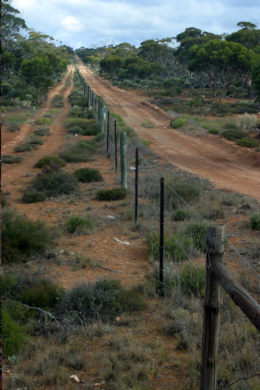
scenery. The famous Dog Fence (pic06), one of the longest fences in the
world erected to keep dingoes away from the sheep, crosses the highway
here after spanning all the way from Queensland. Along the drive, there
are plenty of lookouts as the Nullarbor Plain drops into the ocean in
dramatic cliffs. At the border with Western Australia, we have to stop
for a quarantine inspection for fruit flies. We have reached the westernmost
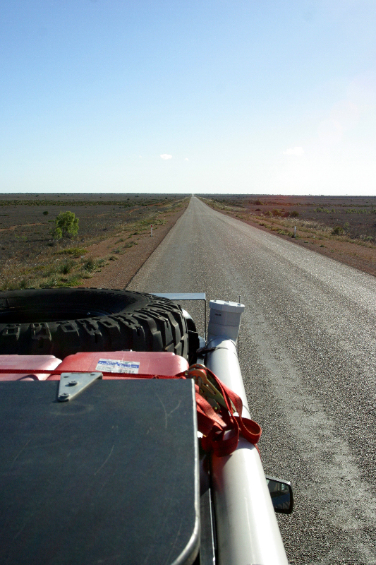
state and have to turn the clock back a whopping 2.5 hours. The longest
straight stretch of road (pic07) in Australia - 90 miles (145 km) - runs
through this desert without a single curve.
After several days on the road through nowhere we reached Norseman, the
first settlement resembling a town where we stocked up before heading
for the coast.
pic01

pic02
pic03
pic04
pic05
pic06
pic07
for more pics click here